Maps of the Middle East (1942 - 1969)
Insofar an Empire draws the maps of the regions under their influence, it also draws a portrait of itself. (S.A.)
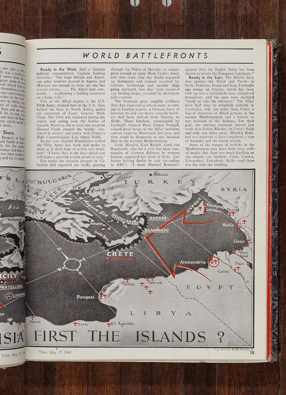
Maps of the Middle East (1942 – 1969) is composed of more than 70 photographs of maps published in the American weekly magazine Time in the period between 1942 and 1969. The majority of the maps are geopolitical or war maps, while others are religious or archaeological. Sven Augustijnen’s photographs of the maps show how political power and focus have changed through the 20th century and the way in which new nations were born and acquired independence.
With a profound interest in historiography, Augustijnen refers to visualization of historical writing as a method to remember and see how history has unfolded and still unfolds. The lines and borders in the Time magazine maps are visible to this day, in our political systems and, generally, in our perception of the world ― how the term ”Middle East” as well as earlier designations such as ”The Orient” or ”Near East” position Europe as the world’s center.
In the exhibition Maps of the Middle East (1942–1969) it becomes clear how objectively we think we can measure the world. The map is not just a practical tool that shows us national borders, mountain formations and the world’s oceans. Equally, the map is a visual symbol of the discourses and the power relations that dictate the measurement of the world. In this exhibition, Sven Augustijnen tries to uncover these relations.
With the support of Kunsthal Aarhus
Courtesy the artist and Jan Mot, Brussels